
MAN MADE
Climate change is a major ongoing issue that will continue to serve us devastating consequences if we don’t recognize its impacts and act. One of my generation’s greatest concerns is reversing the impacts climate change has already made as a result of previous generation’s failures. Our environment is a precious resource. This essay is my attempt to bring awareness of the impact we are having in my home state of Virginia.

37°15'27.3287" N 81°30'3.1895" W Surface mine, Tazewell County, Virginia. While coal use and other fossil fuels contribute heavily to greenhouse gasses. Strip or surface mining also destroys the natural environment, causing erosion, habitat destruction, and air pollution.

37°18'41.601" N 81°20'41.3064" W ATV destruction of Wetland. Pocahontas County. All terrain vehicles when not constrained to roadways can cause major destruction to the environment and threaten waterways. Spearhead Trails has over 600 miles of ATV trails but many abuse the system and create their own paths through the wilderness.

37°2'51.036" N 77°9'0.7972" W Waverly, VA. Channels of water runoff from the garbage field at Atlantic Waste and Disposal is evident. AWD is the fourth largest garbage dump in the United States. Tons of garbage arrive on rail cars from around the country.

38°2'36.2131" N 78°46'59.1699" W Greenwood. In the valley below Afton Mountain, Greenwood Chemical company produced chemicals for industrial, agricultural, pharmaceutical and photographic processes for more than 40 years. "Manufacturing activities ceased in 1985 following a toluene vapor explosion and fire that destroyed the process building and resulted in the deaths of four workers." It is an EPA Superfund site that is still being monitored by the EPA.

“In the environment, every victory is temporary, every defeat permanent.”
—Thomas Jefferson
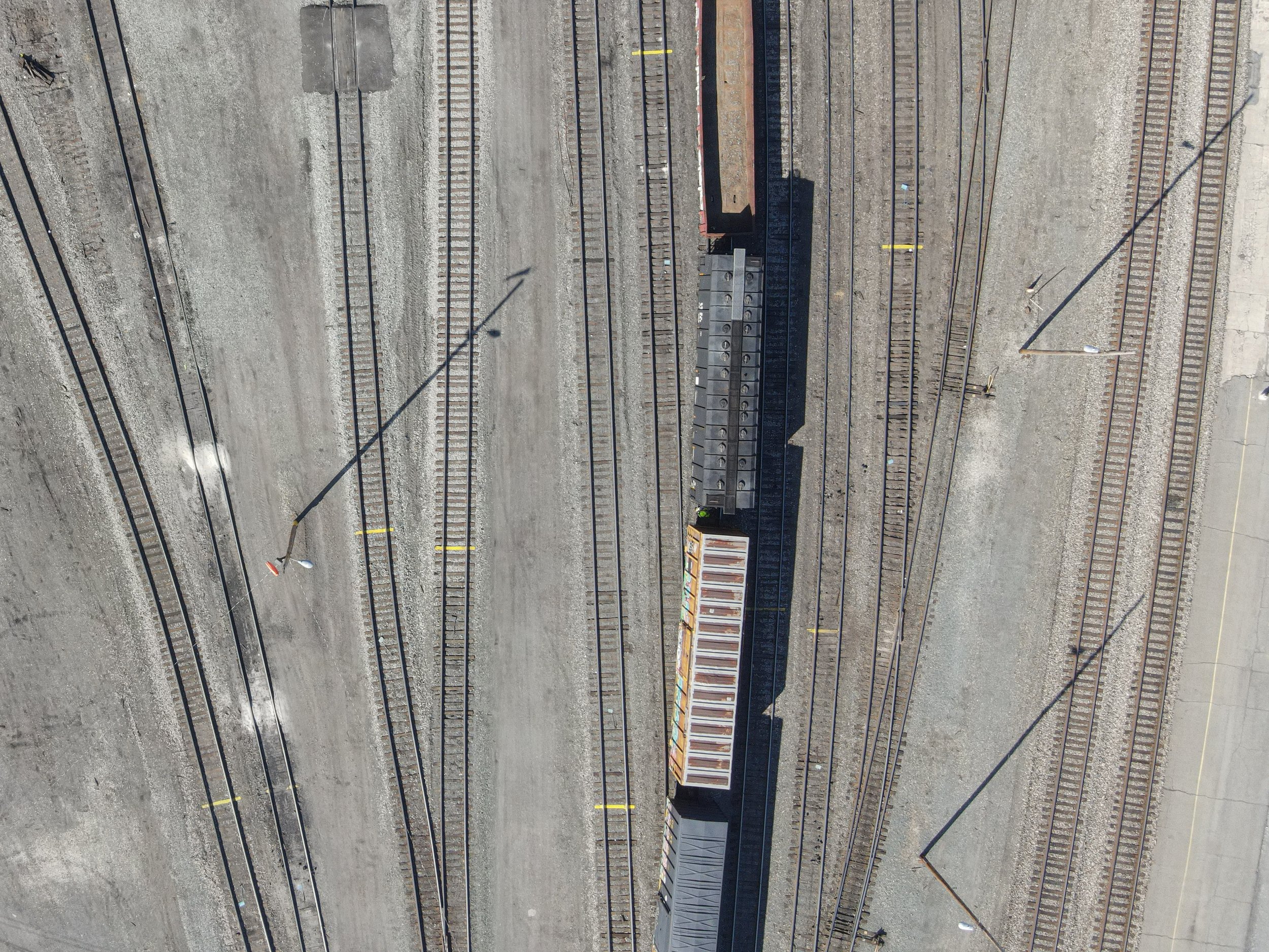
37°48'49.1595" N 79°49'40.0698" W Clifton Forge, Virginia. Rail yard was once one of the largest in the world and the transfer site of billions of tons of coal that was sent around the world. Coal is still one of the main commodities running through the yard.

38°1'27.0587" N 78°27'57.9263" W Charlottesville, Virginia. Junkyard. While vehicles are one of the largest contributors of greenhouse gasses, junk cars pose their own threats to the environment. Plastic pieces of the cars breakdown into micro plastics over time and many of the wires in the car contain toxic substances that can harm the environment.

37°2'51.0232" N 77°9'0.5306" W Waverly, Virginia. Atlantic Waste and Disposal is the 4th largest garbage dump in the United States where tons and tons are trucked and trained into the site daily. Methane released and runoff from the site is toxic. Not to mention the hundreds of acres that have been permanently altered for our waste.

37°42'12.6287" N 79°1'32.5453" W Piney River, Virginia. US Titanium operated in Piney River from the mid 30's until the early 70's. The plant sat on a 50-acre site formerly occupied by an American Cyanamid Company plant which refined titanium ore and manufactured titanium dioxide for paint pigments. According to the EPA, "Acidic storm water runoff from the waste piles and ponds and acidic ground water seeps/springs contributed to six major fish kills in the Piney and Tye Rivers from 1977 to 1981. As a result of these releases, more than 200,000 fish died." It is a Superfund site.

I chose to document mankind’s impact on the environment of Virginia to shine light upon the many destructions we’ve made to our environment in our commonwealth. Out of all the photography techniques, I decided to use a drone because looking straight down provides a new view point and shows the scope and scale of the problems. I also decided to turn the majority of my photos black and white to make the many different shapes stand out more. I travelled all over Virginia to investigate the impact man has had on our environment.

37°48'0.198" N 79°59'29.393" W Covington, Virginia. The Jackson River above the Westvaco Paper Mill is clear and full of native trout. Below the factory, the color turns to rust, the temperature warms too much for native trout and many fish species have diseases.

37°19'49.7323" N 80°34'53.0907" W Giles County, Virginia. The Mountain Valley Pipeline cuts a swath through the landscape. Also pictured are Dominion Energy power lines and a surface mine in the background.

38°3'44.1175" N 78°44'54.4919" W Greenwood, Virginia. Chiles Orchard. Orchards can have a positive impact on the environment in that the trees can capture CO2 but there are also downsides: habitat destruction, pesticide runoff, and erosion.

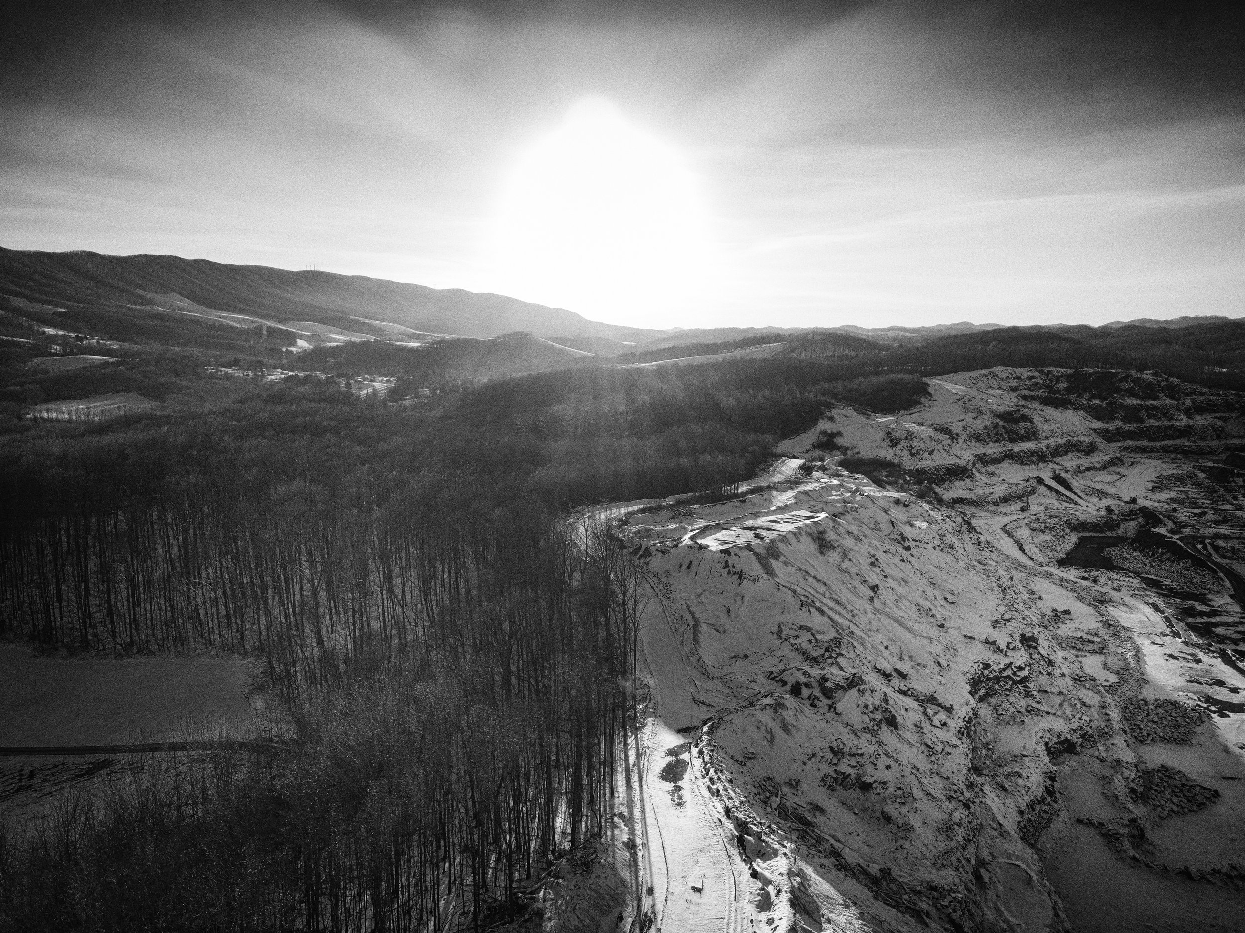
37°13'54.599" N 81°19'58.437" W Bluefield, Virginia. Appalachian Aggregate Quarry. There are a number of environmental concerns regarding quarries: surface water disruption, erosion, loss of habitat, dust, vibrations and chemical spills to name a few. In Virginia there are approximately 137 aggregate mines.
I hope those who set eyes upon my photos take into consideration the damages we’ve done to our state so we can prevent even more from happening. I hope that in the future, we can all unite to strive to provide solutions to combat climate change and protect our environment in order to protect our home. There is a balance between our quality of life and our natural environment. The more our environment is harmed, the more we will personally suffer from it.

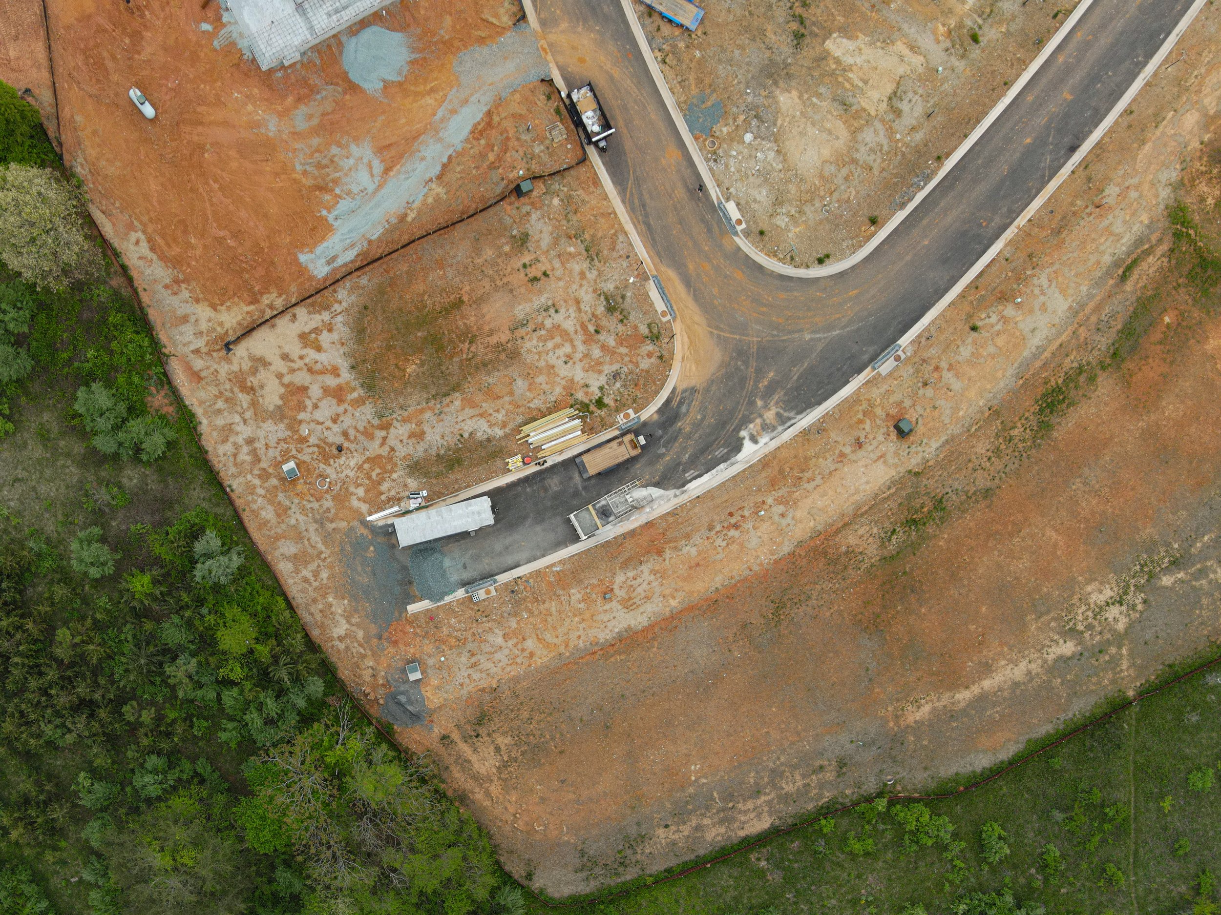
38°4'0.4759" N 78°41'22.2176" W Crozet, Virginia. High density housing developments encroach on farmland.

37°15'26.9759" N 81°30'1.8405" W Tazewell, County, Virginia. Surface coal mine. Also known as mountaintop removal. Runoff from sites like this leach toxic chemicals into native streams and creeks and also threaten drinking water.

37°13'58.9455" N 81°20'0.2572" W Bluefield, Virginia. Appalachian Aggregate.

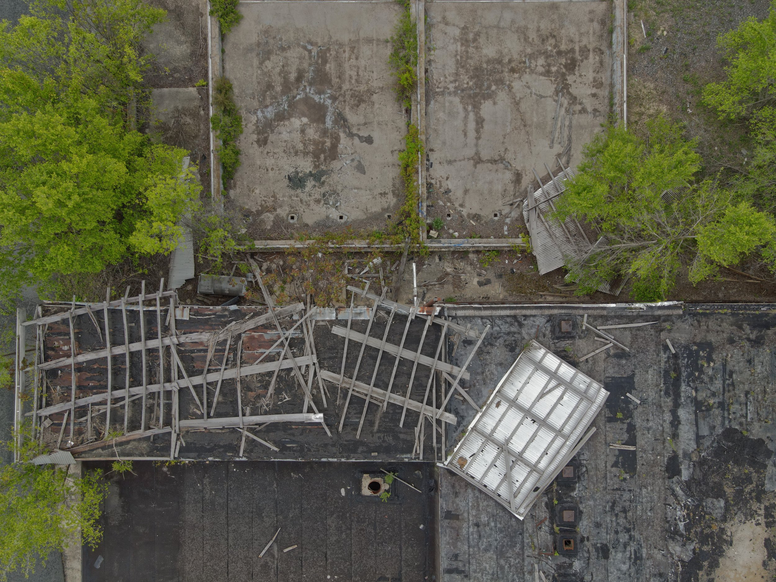
38°4'7.964" N 78°41'57.3481" W Crozet, Virginia. Site of an abandoned factory in downtown Crozet.

37°42'15.2532" N 79°1'30.5651" W Piney River, Virginia. Piney River Cyanamid superfund site.

“Never doubt that a small group of thoughtful, committed citizens can change the world; indeed, it is the only thing that ever has.”
—Margaret Mead
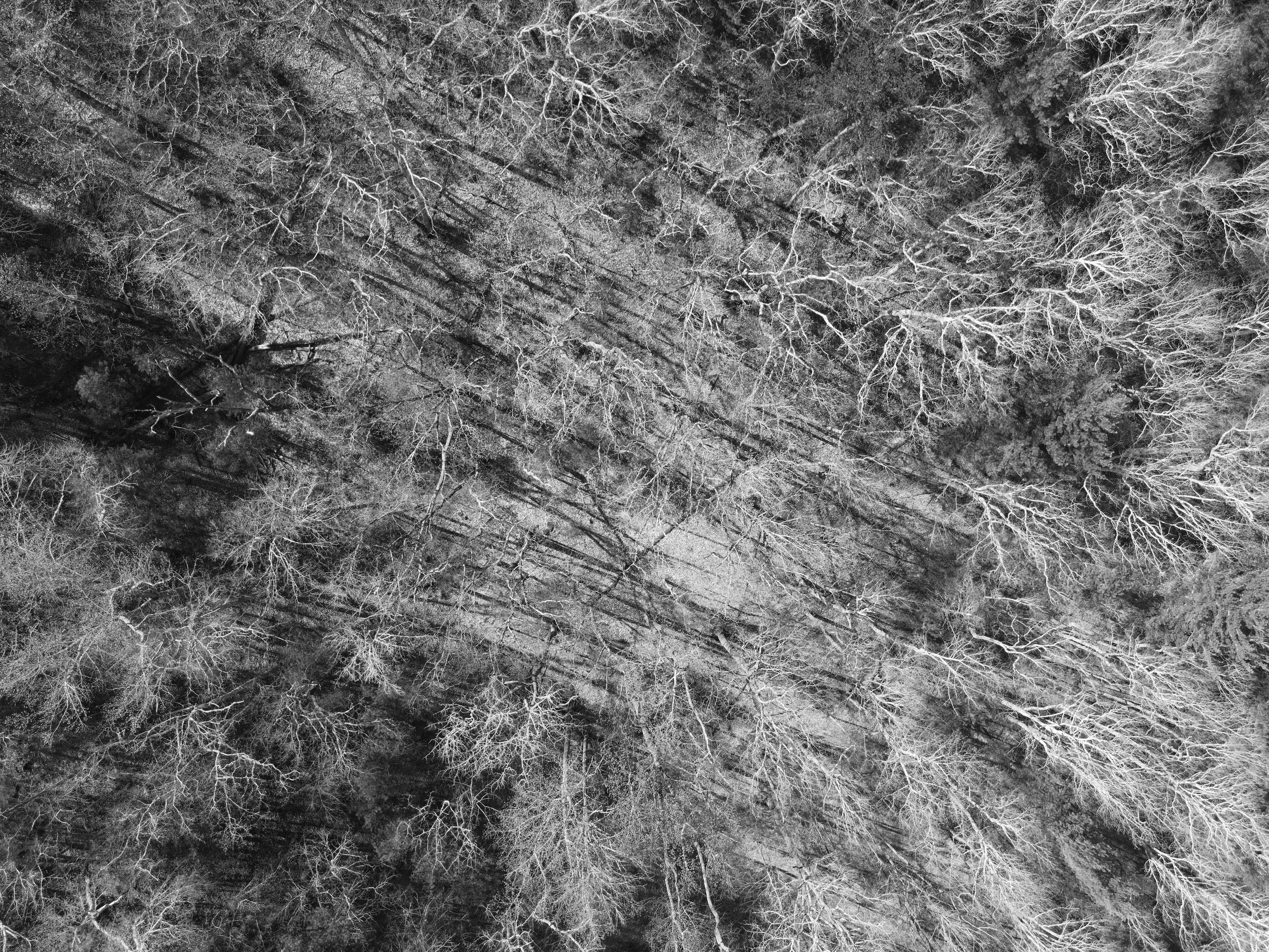
38°2'44.0018" N 78°43'15.5689" W Yancey Mills, VA. Deforestation. Cutting trees releases carbon dioxide into the atmosphere and is one of the leading contributors of human-made carbon dioxide. Sustainable farming is a good practice but new trees take decades to regrow to achieve the desired effects of CO2 sequestration.
37°49'28.624" N 79°39'33.4369" W Longdale, VA. Remains of a forest fire caused by humans. In 2021 more than 1.8 million acres burned globally, releasing massive amounts of carbon dioxide into the atmosphere and potentially causing other issues with the environment like erosion. https://atmosphere.copernicus.eu/wildfires-wreaked-havoc-2021-cams-tracked-their-impact

37°3'28.3071" N 77°10'47.4216" W Waverly, VA. Atlantic Waste and Disposal operates a garbage dump of more than 1300 acres. Methane released from garbage dumps is one of the leading causes of human made climate change. Now that recycling has all but stopped in Virginia, tons of plastic are also filing landfills. These plastics will break down into micro plastics and can last in the environment for centuries.

38°4'6.5307" N 78°41'55.2332" W Crozet, VA. Dilapidated building sits in the heart of Crozet. Studies have shown that vacant and decaying buildings can pose a number of concerns for citizens who live nearby. One can come from the fact that many of these dwellings contain harmful chemicals in wiring, paint and pipes like lead, mercury and asbestos.

37°15'18.0095" N 81°29'47.1362" W Tazewell County, VA. Ice forms on a layer of water sitting on top of a surface mine.

37°42'16.5568" N 79°1'28.4799" W Piney River, VA. Superfund site.
Along my travels across Virginia, I experienced many different kinds of disasters, from forest fires to factories leaking decades of toxic waster to junk yards and garbage dumps. Each place I visited made me feel disgust seeing how we’ve been treating our environment and how no one has attempted to notice. It made me want to spread awareness with this website and my photos so we can prevent this from happening.
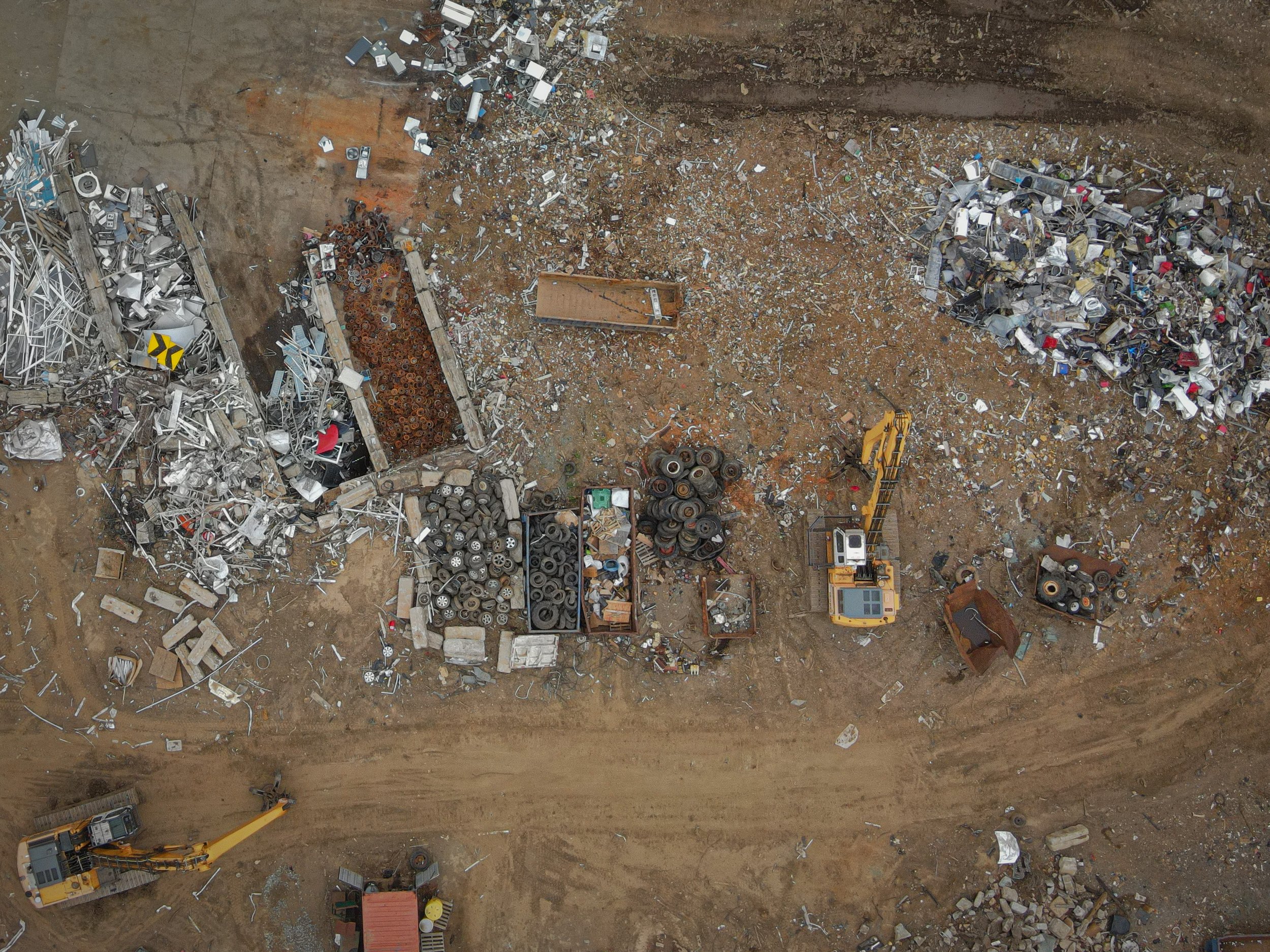
38°1'22.1927" N 78°28'0.3943" W Charlottesville, VA. Remains of deconstructed automobiles are segmented at a junkyard in a residential area of Charlottesville.

37°3'19.5958" N 77°11'2.0652" W Waverly, VA. A truck hauling waste passes by an abnormally green holding pond at Atlantic Waste and Disposal.

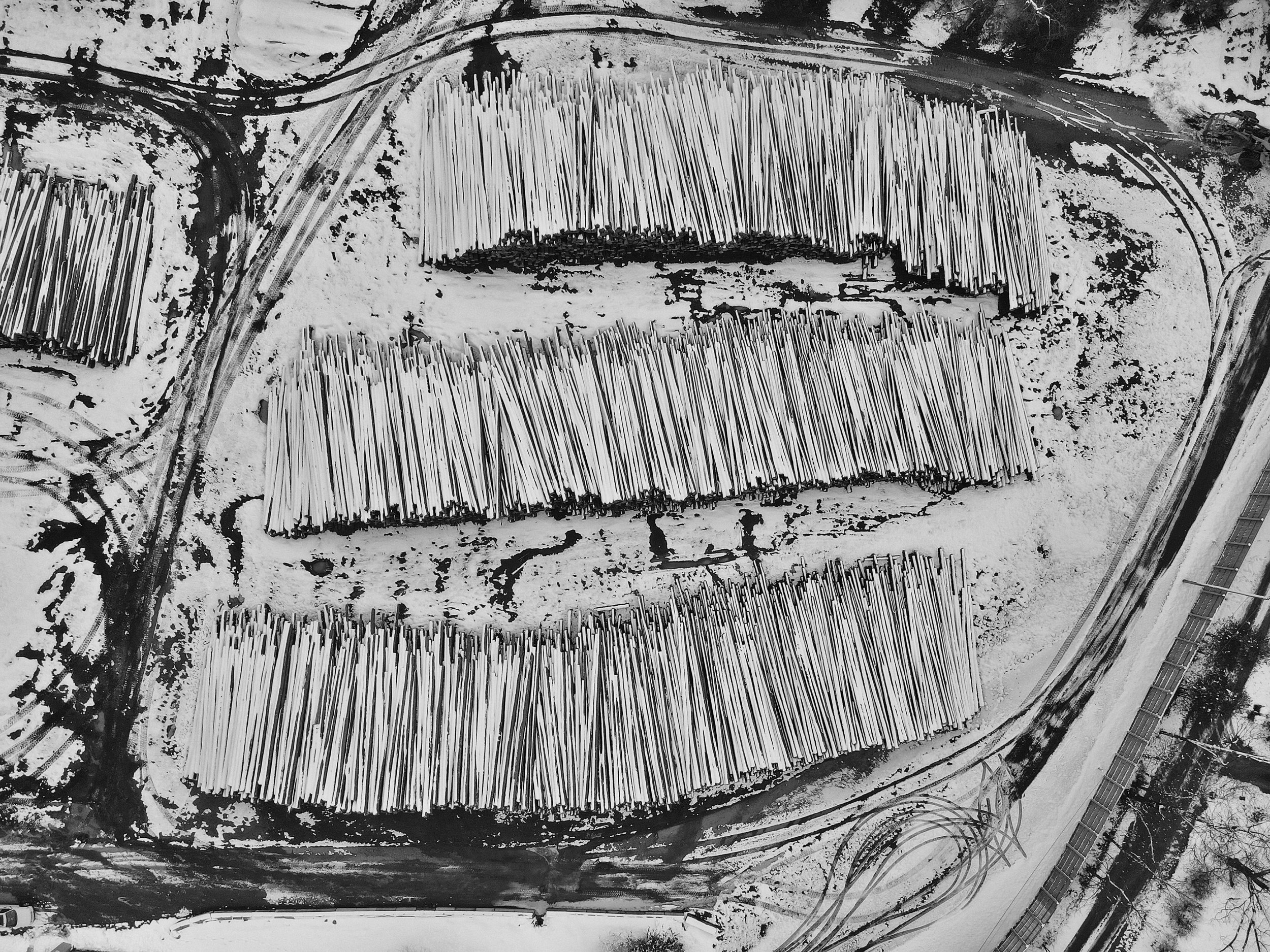
38°3'45.6499" N 78°44'54.0106" W Greenwood, VA. A huge pile of peach trees that have been cut are stacked in a pile.

38°4'5.2228" N 78°41'58.0928" W Crozet, VA. The site of illegal garbage dumping in downtown Crozet.

How does seeing these images make you feel? What steps can you take to protect our environment and work towards reducing our carbon footprint?

37°19'51.8351" N 80°34'59.2792" W Giles County, VA. A scar is left across farmland in Giles County from the Mountain Vally Pipeline. Because of environmental failures, the MVP is halted.

38°4'6.5307" N 78°41'55.2332" W Crozet, VA. The dilapidated xx building in Crozet is not only an eyesore, the decomposing building potentially has toxic materials like asbestos and lead that could leach out.

38°3'54.7983" N 78°41'24.5558" W Crozet, VA. New housing development in Crozet encroaches on a forest. Demand for new housing in the region has prompted developers and county officials to increase the amount and size of high density neighborhoods.

37°47'50.1604" N 79°59'32.0895" W Covington, VA. Westvaco paper mill.
If you would like to support those working to preserve our natural resources in Virginia please consider donating to the Southern Environmental Law Center with headquarters in Charlottesville.
This photo essay was done as part of my independent study resarch project at Western Albemarle High School. I would like to thank my advisor Zoe Padron and my mentor Matt Eich for their advice and support.